CropMap / Crop maps by country / France
Crop map of France
CropMap shows 27.1 M ha of mapped area in France. The largest crops on the map are wheat (4.4 M ha), maize (2.9 M ha), barley (1.8 M ha). Grassland and pasture make up 34% of the mapped area.
Mapped area
27.1 M ha
on the CropMap map
Crop groups
23
with at least 10 k ha
Top crop
Wheat
4.4 M ha · 16%
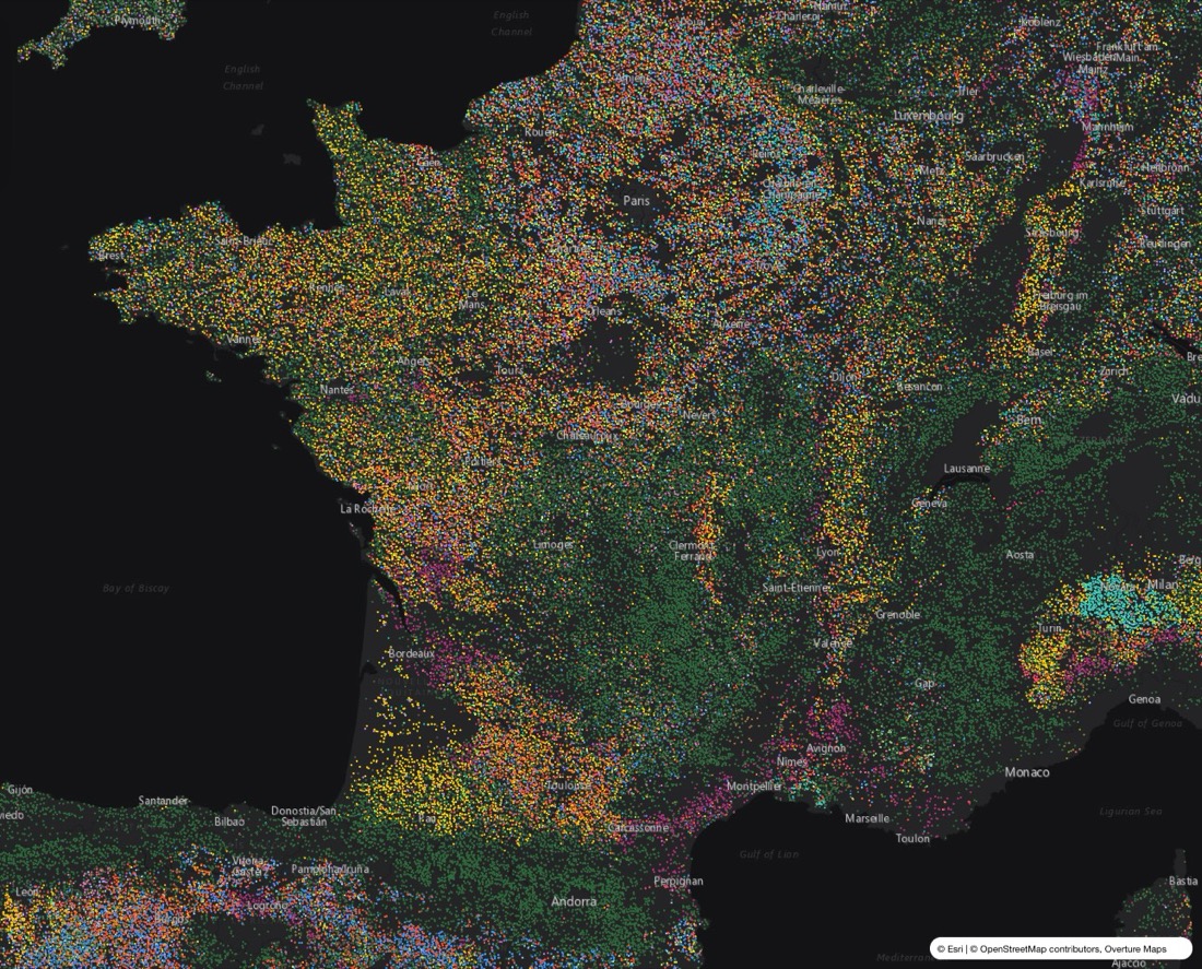
Each dot is about 25 ha of land, coloured by crop.
Crops in France
| Crop | Area | Share | |
|---|---|---|---|
| Grassland | 9.3 M ha | 34% | |
| Wheat | 4.4 M ha | 16% | |
| Maize | 2.9 M ha | 11% | |
| Fodder crops | 2.1 M ha | 7.8% | |
| Barley | 1.8 M ha | 6.7% | |
| Rapeseed & mustard | 1.3 M ha | 4.9% | |
| Sunflower | 743 k ha | 2.7% | |
| Other | 705 k ha | 2.6% | |
| Cropland, crop unknown | 656 k ha | 2.4% | |
| Vineyards | 605 k ha | 2.2% | |
| Other cereals | 477 k ha | 1.8% | |
| Sugar beet | 435 k ha | 1.6% |
Detail available
Field-level crop map: individual parcels, each with its crop type.
Questions
What are the main crops in France?
On the CropMap map, the largest crops in France are wheat (4.4 M ha), maize (2.9 M ha), barley (1.8 M ha). Grassland and pasture make up 34% of the mapped area.
Is there a field-level crop map of France?
Field-level crop map: individual parcels, each with its crop type.
How can I get crop data for France?
Through a REST API, vector tiles for your own map, or bulk export (GeoJSON, GeoPackage, Parquet), grouped to your own crop classes. Request a free sample for your region at cropmap.ai.