CropMap / Crop maps by country / United States
Crop map of the United States
CropMap shows 140.1 M ha of mapped area in the United States. The largest crops on the map are maize (41.0 M ha), soybean (32.4 M ha), wheat (17.3 M ha).
Mapped area
140.1 M ha
on the CropMap map
Crop groups
25
with at least 10 k ha
Top crop
Maize
41.0 M ha · 29%
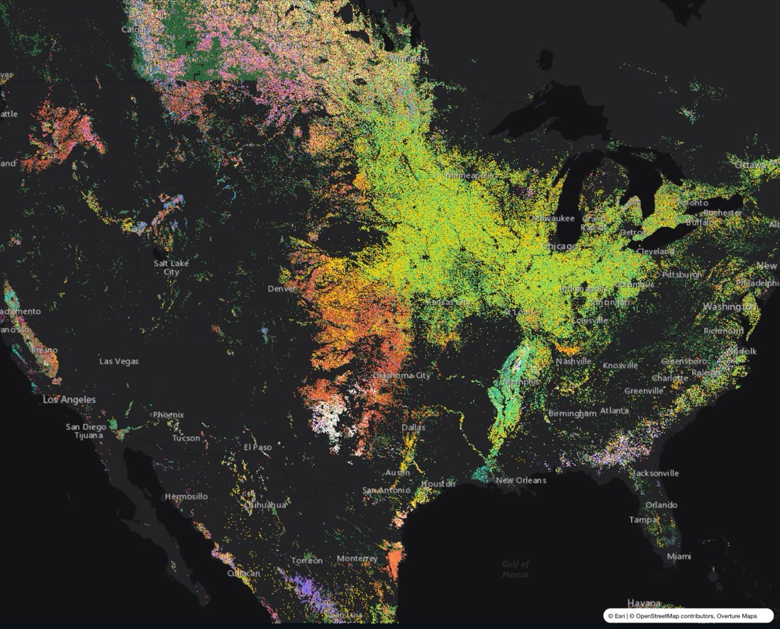
Each dot is about 25 ha of land, coloured by crop.
Crops in the United States
| Crop | Area | Share | |
|---|---|---|---|
| Maize | 41.0 M ha | 29% | |
| Soybean | 32.4 M ha | 23% | |
| Wheat | 17.3 M ha | 12% | |
| Grassland | 15.0 M ha | 11% | |
| Fodder crops | 8.3 M ha | 5.9% | |
| Cropland, crop unknown | 5.5 M ha | 4.0% | |
| Cotton | 3.8 M ha | 2.7% | |
| Sorghum | 3.2 M ha | 2.3% | |
| Pulses | 2.8 M ha | 2.0% | |
| Other cereals | 1.4 M ha | 1.0% | |
| Nuts | 1.3 M ha | 0.9% | |
| Rice | 1.2 M ha | 0.8% |
Detail available
Crop type for every field across the contiguous United States, with the crop sequence of each field over several seasons.
Questions
What are the main crops in the United States?
On the CropMap map, the largest crops in the United States are maize (41.0 M ha), soybean (32.4 M ha), wheat (17.3 M ha).
Is there a field-level crop map of the United States?
Crop type for every field across the contiguous United States, with the crop sequence of each field over several seasons.
How can I get crop data for the United States?
Through a REST API, vector tiles for your own map, or bulk export (GeoJSON, GeoPackage, Parquet), grouped to your own crop classes. Request a free sample for your region at cropmap.ai.